
University of Missouri researchers are advancing drone autonomy using AI, focusing on navigation and environmental interaction without GPS reliance. Credit: SciTechDaily.com
A leading-edge project led by University of Missouri researchers aims to equip drones with autonomous visual navigation capabilities, potentially transforming the way drones operate and assist in critical scenarios like natural disasters.
AI algorithms are being developed to allow drones to autonomously navigate and perform complex tasks, especially in 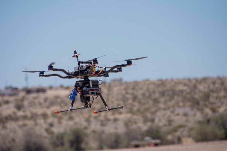
University of Missouri students spent a month at Yuma Proving Grounds in Arizona, one of the largest military installations in the world, working to collect visible and infrared video data using custom-built drones. Their project helped build the foundation for this two-year project supported by the U.S. Army Engineer Research and Development Center. Credit U.S. Department of Defense
AI-Driven Drone Navigation
Thanks to smart algorithms powered by
Autonomy in Critical Situations
The ability to operate autonomously becomes critical in situations when there is an interruption or loss of signal from GPS navigation, such as following a natural disaster or in military situations, said Kannappan Palaniappan, a Curators’ Distinguished Professor of electrical engineering and computer science and principal investigator on the project.
“This typically occurs in the aftermath of natural disasters, occlusions in the built environment and terrain or from human-involved intervention,” Palaniappan said. “Most drones operating today require GPS navigation to fly, so when they lose that signal, they aren’t able to find their way around and will typically just land wherever they are. Unlike ground-based GPS navigation apps, which can reroute you if you miss a turn, there’s currently no option for airborne drones to re-route in these situations.”
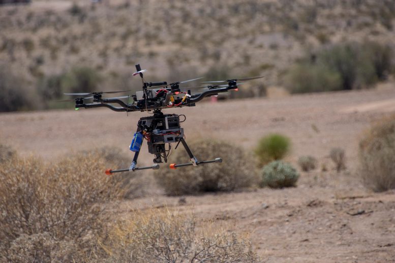
University of Missouri students spent a month at Yuma Proving Grounds in Arizona, one of the largest military installations in the world, working to collect visible and infrared video data using custom-built drones. Their project helped build the foundation for this two-year project supported by the U.S. Army Engineer Research and Development Center. Credit U.S. Department of Defense
Enhancing Drones with Smart Technology
Currently, someone must manually fly a drone and have a high level of situational awareness to keep it clear of obstacles in its surroundings, like buildings, trees, mountains, bridges, signs or other prominent structures, while staying within the drone pilot’s line of sight. Now, through a combination of visual sensors and algorithms, Palaniappan and team are developing software that will allow drones to fly on their own — independently perceiving and interacting with their environment while achieving specific goals or objectives.

Kannappan Palaniappan. Credit: University of Missouri-Columbia
“We want to take the range of skills, attributes, contextual scene knowledge, mission planning and other capacities that drone pilots possess and incorporate them — along with weather conditions — into the drone’s software so it can make all of those decisions independently,” Palaniappan said.
Advancing Intelligent Scene Perception
In recent years, advancements in visual sensor technology like light detection and ranging, or lidar, and thermal imaging have allowed drones to perform limited advanced-level tasks such as object detection and visual recognition. When combined with the team’s algorithms — powered by deep learning and SciTechDaily